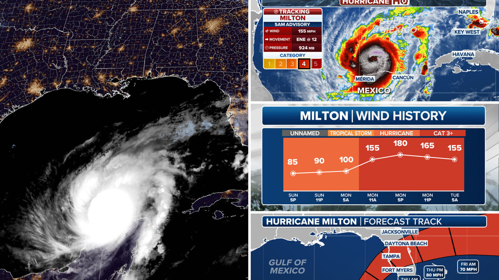
While Milton weakened slightly, forecasters are warning of “life-threatening” conditions as the hurricane nears Florida’s Gulf Coast, where it is expected to come ashore — likely in the Tampa Bay region — sometime Wednesday evening.
Some of the most recent projections suggest Milton could hit south of Tampa, near Sarasota.
“This is an extremely life-threatening situation & residents should follow the advice given by local officials & evacuate immediately if told to do so,” the National Hurricane Center warned.
Forecasters say that Milton, which underwent rapid intensification Monday and strengthened from a Category 1 storm to a near-record-breaking Category 5 hurricane, will make landfall as a still-powerful Category 3 storm, with winds of 111-129 mph.
While it has weakened over the coast of Mexico’s Yucatan Peninsula, forecasters say Milton will remain an “extremely dangerous hurricane” through landfall along Florida’s west coast.
Forecasters also predict Milton will come ashore in the Tampa Bay region, which has not endured a head-on hit by a major hurricane in over a century.
Cities including Tampa, Fort Myers, Orlando and Jacksonville are all in the forecast cone for Hurricane Milton, according to Fox Weather.
Spaghetti models for the storm, however, show Milton’s path shifting slightly south — and likely to pass directly through Sarasota, which is about an hour south of Tampa.
Even if the “eye” of the storm falls south of Tampa, officials warn the region will likely face mass devastation from the powerful hurricane.
A storm surge warning has been issued for the west coast of Florida as the National Hurricane Center warns storm surge in the Tampa Bay area could reach 10 to 15 feet above ground level.
The highest surge is expected between an area north of Clearwater to an area just north of Sarasota.
The storm is also expected to drench portions of the state still reeling from Hurricane Helene before heading out toward the Atlantic Ocean, sparing other states ravaged by the previous storm.
The hurricane center warned heavy rainfall of up to 15 inches in portions of the Florida peninsula could generate “considerable flash, urban and areal flooding, along with moderate to major river flooding.”
The storm is also expected to drench portions of the state still reeling from Hurricane Helene before heading out toward the Atlantic Ocean, sparing other states ravaged by the previous storm.
Florida Gov. Ron DeSantis on Monday urged those in the hurricane’s path to find their way to safety.
“Evacuations are underway, and we have suspended tolls and opened roadway shoulders to make it easier for Floridians to get to safety,” DeSantis said.
“The State of Florida continues to fulfill requests from communities in the potential path of Hurricane Milton as we prepare for landfall. Hundreds of first responders will be embedded in potential impact sites along Florida’s west coast to begin search and rescue operations as soon as the storm passes.”
With Post wires
Advertisement
