FOX Weather meteorologists are tracking what’s expected to become the first nor’easter of 2024, which could bring the first significant snow in two years for several cities along the East Coast and flooding rain for the South, all translating to messy weekend travel across the eastern U.S.
The storm is forecast to develop Friday along the Gulf Coast. While computer forecast models still vary widely on snow and rain amounts and the actual track and strength of the storm, the FOX Forecast Center is keeping an eye on key takeaways that will spell out dangerous and slow travel conditions:
This nearly two-year streak without an inch of snow for Philadelphia smashed the previous record streak of 661 days without an inch of snow that ended in 1973.
Long ago, New York City clobbered its old record of 383 days without an inch of snow that ended in 1998.
New York City only saw 2.3 inches of snow over the winter of 2022 through 2023.
That is more than a 2-foot deficit compared to the average winter season snowfall and a record for the lowest annual snowfall total.
Philadelphia and Washington both saw less than a half-inch, leaving those cities with a 22.8-inch and 13.3-inch deficit, respectively.
Even cities that saw snow got only a fraction of what they typically see. Boston saw 49.2 inches of snow over the 2022-23 winter, more than 3 feet less than average.
The storm is expected to impact at least 20 states from Texas to New England.
The Gulf Coast could see another round of heavy rain, triggering flood concerns. The Interstate 10 and 20 corridors and southern portions of the I-95 corridor will deal with wet pavement.
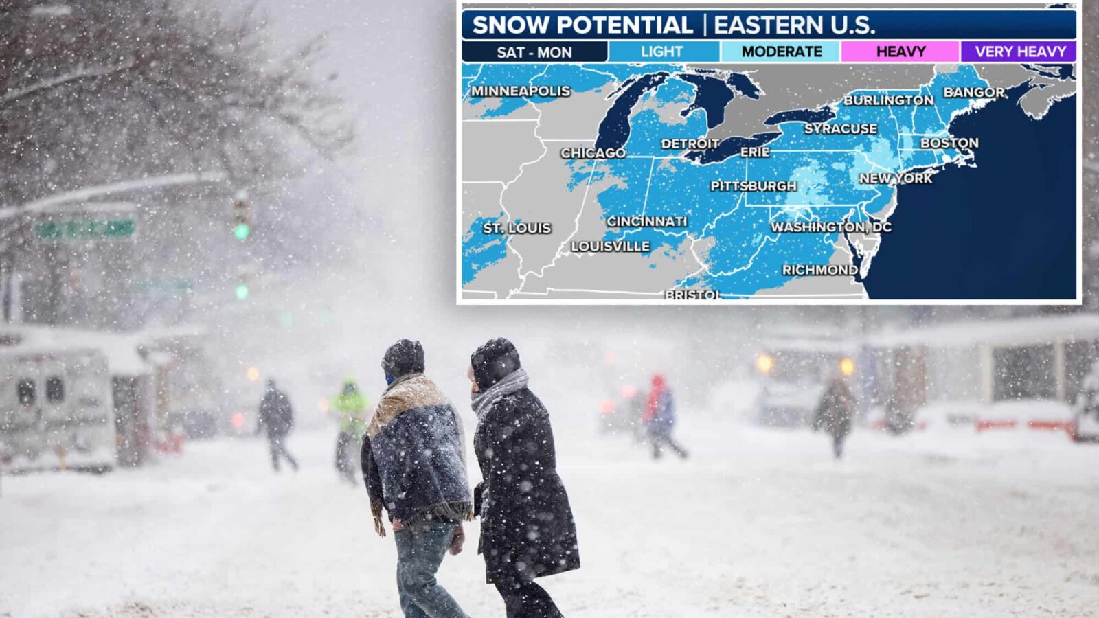
The storm will then slide northward near or off the East Coast as it collides with the cold air. Anyone living from parts of West Virginia to New England could be in for plowable snow.
“We were telling you at the end of 2023 that as we entered January, we were expecting the storm track to be more favorable for the East Coast, but also the cold air to be present,” FOX Weather Meteorologist Britta Merwin said. “Well, there you go. Verified forecast. We’re in for a nor’easter this weekend, and this is going to all happen very quickly.”
“We’re going to see changes, but right now, we have a moderate snow potential for northwest New Jersey and lower Hudson Valley,” Merwin continued. “The general trend on the computer models is of lowering snow totals, but this is an area that hasn’t seen snow. So, even if you get 6 inches of snow, which would be low for a nor’easter, that’s going to be substantial for an area that hasn’t seen much snow in two years.”
“We were telling you at the end of 2023 that as we entered January, we were expecting the storm track to be more favorable for the East Coast, but also the cold air to be present,” FOX Weather Meteorologist Britta Merwin said. “Well, there you go. Verified forecast. We’re in for a nor’easter this weekend, and this is going to all happen very quickly.”
The FOX Forecast Center said there is also a growing threat of freezing rain in the central and southern Appalachians. Parts of southwestern Virginia, western North Carolina, upstate South Carolina and northeastern Georgia could see significant icing, putting a slippery glaze on pavement and weighing down tree limbs and power lines.
An area of low pressure is expected to develop between Houston and New Orleans on Friday, producing heavy rain along the Gulf Coast. Flash flooding is possible from southeastern and eastern Texas eastward to the Florida Panhandle.
Morning Report delivers the latest news, videos, photos and more.
Please provide a valid email address.
By clicking above you agree to the Terms of Use
and Privacy Policy.
Thanks for signing up!
Never miss a story.
On Saturday, the low-pressure system is forecast to plow east as it organizes and strengthens. Check with your airline if you are flying into or out of Atlanta, the world’s busiest airport, as the heavy rain and gusty winds could create delays, especially in the morning.