WASHINGTON — Flood and high wind alerts have been issued for certain parts of the East Coast.
The FOX Forecast Center is tracking a powerful pre-holiday storm affecting millions in at least 20 states. The storm is expected to bring heavy rain and strong winds and will continue to impact the region through early next week.
If you’re among the more than 115 million Americans expected to travel 50 miles or more this holiday season, you’ll want to prepare for road delays and at some of our nation’s busiest airports if your journey takes you to the East.
“Timing is everything,” FOX Weather Meteorologist Craig Herrera said. “When you’re talking about Sunday, Monday, this is when we’re watching all of this energy coming together.”
The impacts from the storm will vary as it slides up along the Interstate 95 corridor.
“This is really one of those systems that is going to produce a whole lot of rain up and down the I-95 corridor,” Herrera continued. “You’re talking rain, more of it, from Florida clear up into New England.”
In addition, strong to damaging wind gusts are possible along coastal cities as the powerful storm system tracks along the Atlantic Coast.
The primary threats from the storm include heavy rain and flooding and impactful winds akin to tropical storm strength near the storm center.
While it appears the strongest winds will remain offshore, sustained winds will blow to 20-40 mph, with gusts along the Atlantic coastlines even reaching 60 mph or higher.
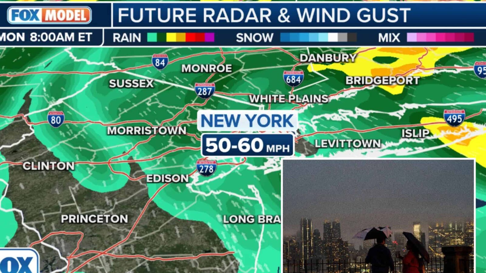
Wind Advisories cover some 20 million along the Atlantic Coast from southern Florida into New Jersey for gusts of 50-55 mph on Sunday.
Farther north, High Wind Watches cover an additional 12 million people in the Northeast late Sunday into Monday from Brooklyn and Queens in the New York City area across Long Island and coastal Connecticut, into Massachusetts’ Cape Cod and even Boston. Another watch covers Downeast Maine.
Gusts could reach 55 mph around Boston and 60 mph along Long Island and New York City’s eastern boroughs.
“This is going to be the part that you really want to focus in on as we work our way through the weekend,” says FOX Weather Meteorologist Britta Merwin.
Gusts could reach 55 mph around Boston and 60 mph along Long Island and New York City’s eastern boroughs.
With winds pushing water onshore along the Eastern Seaboard, coastal flooding will become a concern for multiple states in the storm’s path.
Big waves, perhaps as large as 15 feet, battering beaches up and down the coastline will also lead to beach erosion through early next week.
There’s also the possibility that cold air could get wrapped up on the back side of the system as it pushes farther north, producing snow in parts of the Northeast and northern New England.
At the region’s busy airports, rain combined with low clouds will slow down arrivals and departures, and the wind will also create issues for planes attempting to take off or land on some runways depending on their direction.
As the coastal storm advances northward, the highest rainfall totals will likely be found in the Southeast and mid-Atlantic.
Between 2-3 inches is expected across much of the area. However, parts of the Carolinas, Georgia and the Florida Panhandle could pick up between 3-5 inches by the time the storm moves out of the region on Monday.
A flash flood risk on Sunday into Monday includes southern Virginia, most of North Carolina and South Carolina, and areas of northeastern Georgia.