See more of our coverage in your search results.
Just on the heels of last week’s severe weather outbreak across the Midwest, the threat of additional severe storms is increasing.
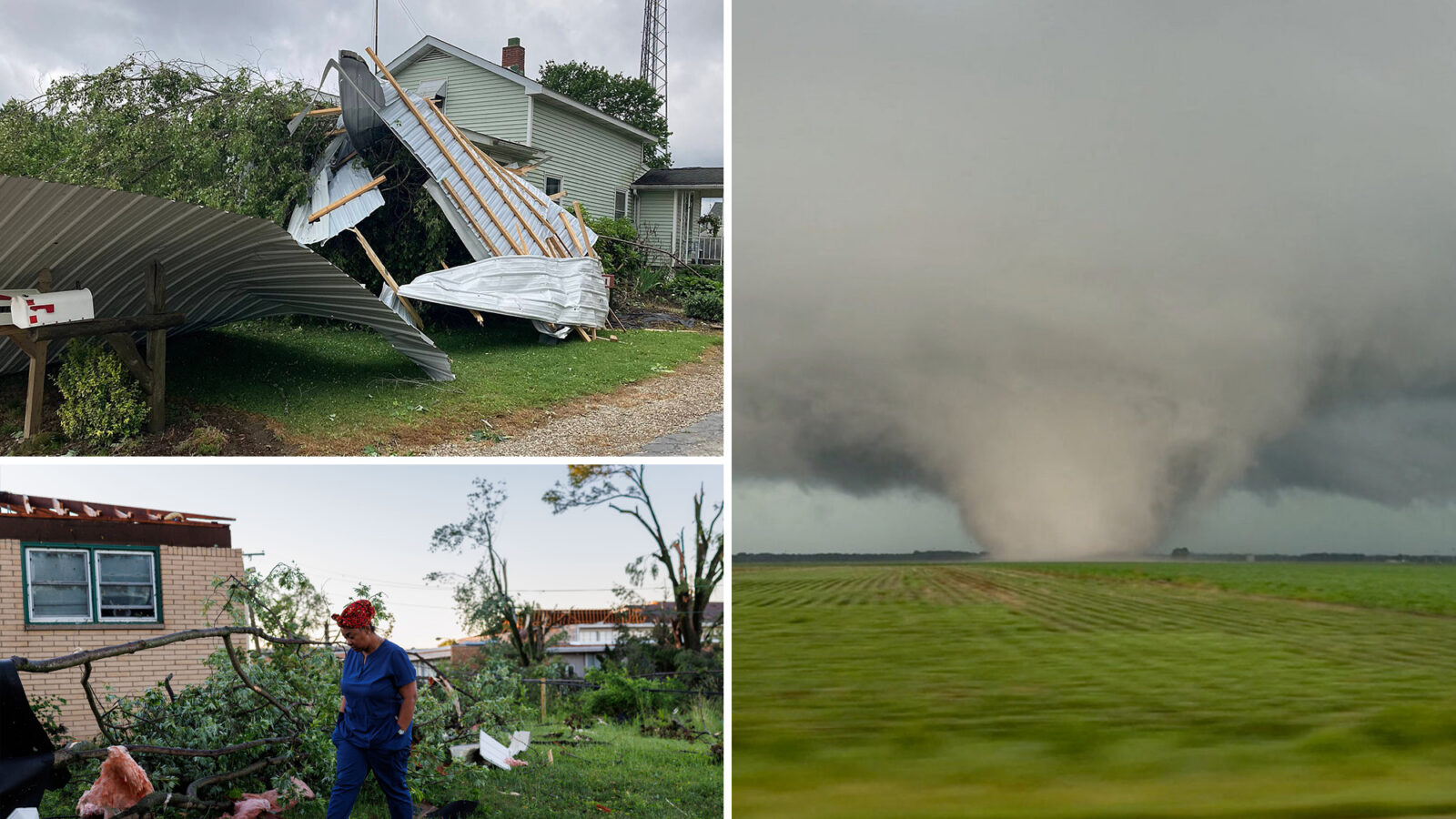
Concerns are rising about another potential outbreak on Wednesday, just days after tornadoes, damaging winds and large hail battered many of these same areas.
The FOX Forecast Center has issued an Extreme Risk for Wednesday just south of Chicago for portions of northern Illinois and northwestern Indiana for the risk of flash flooding and strong tornadoes.
As of this morning, the National Weather Service has issued a Severe Thunderstorm Watch for portions of Iowa and northwest Illinois.
Last week, a severe system unleashed dozens of tornadoes ranging from EF-0 to EF-3 across the region.
Accompanied by destructive straight-line winds, the storms left communities with catastrophic damage, destroying homes, toppling trees and downing power lines that knocked out electricity to thousands of residents.
These hard-hit communities have faced a relentless onslaught since the severe season kicked off in March.
In fact, Illinois has been one of the hardest-hit states this year, leading the nation in tornado reports.
After more scattered storms impacted the Midwest on Tuesday, a dangerous day of severe weather arrives on Wednesday as a stronger low-pressure system tracks from the Midwest into the Great Lakes.
Ahead of the system, the Storm Prediction Center has issued a Level 4 out of 5 severe storm threat across north-central Illinois and western Indiana.
Morning Report delivers the latest news, videos, photos and more.
Please provide a valid email.
Morning Report delivers the latest news, videos, photos and more.
By clicking above you agree to the Terms of Use and Privacy Policy.
Never miss a story.
Along with that, a Level 3 out of 5 risk spans from Kansas City to St. Louis and northward into Chicago, while a broader Level 2 out of 5 risk blankets a wider zone from Kansas to Louisville, Indianapolis and Columbus.
The FOX Forecast Center said there could be two distinct rounds of severe storms: One in the morning to afternoon hours bringing damaging winds and large hail — up to 2.5 inches in diameter—followed by a second round as atmospheric conditions rapidly destabilize by Wednesday afternoon.
Given the strong wind shear in place, discrete supercells capable of producing intense, long-track tornadoes—EF-3 or stronger — are expected to develop initially.
Through the evening hours, these storms will develop into an intense line of severe storms, bringing a widespread threat of destructive, straight-line winds upwards of 75 mph across the region.
The FOX Forecast Center said a powerful low-level jet stream will cause storms to move rapidly as they develop, meaning dangerous weather could impact areas quickly—just in time for the evening commute.