This powerful storm is approaching the Midwest after powerful wind gusts left hundreds of thousands of customers without power across the Pacific Northwest, Northern Plains, and the Rockies on Wednesday.
Numerous wind gusts in excess of 100 mph have been reported across the Intermountain West and Northern Plains since Wednesday, including a 144 mph gust on Mount Coffin, Wyoming.
A wind gust of 78 mph on Wednesday set a new December wind record in Glasgow, Montana.
Two children were critically injured in Twin Falls, Idaho, on Wednesday, after high winds toppled rotting trees onto them while they were waiting for the bus, officials said.
The sheriff’s department in Kootenai County, Idaho, said a falling tree killed a man sleeping in his home in Fernan Lake Village on Wednesday afternoon and warned people to stay away from large trees during high wind events.
High winds also drove the spread of several large wildfires in South Dakota, Wyoming, and Colorado on Wednesday.
Evacuations were issued as a wildfire grew to at least 200 acres in Pennington County, South Dakota.
Wildfires outside of Cheyenne, Wyoming, and a massive blaze that reached 40,000 acres in Yuma County, Colorado, also prompted evacuations on Wednesday.
More than 100,000 customers were without power across Colorado early Thursday as strong wind gusts continued to pound the state.
High Wind and Fire Weather Warnings will remain across the Intermountain West on Thursday as dry air rushes in to fill the space behind the storm.
Meanwhile, high winds and heavy rain exacerbated last week’s historic flooding in Washington. Powerful wind gusts compounded the existing power outages caused by the ongoing flooding across Washington early Wednesday.
A 71 mph wind gust was clocked at Naval Air Station Whidbey Island in the Puget Sound, and a 138 mph gale was recorded on Mount Hood, Oregon.
More than 61 thousand customers were still without power across Washington early Thursday.
A 71 mph wind gust was clocked at Naval Air Station Whidbey Island in the Puget Sound, and a 138 mph gale was recorded on Mount Hood, Oregon.
Power outages impacted more than 350,000 customers in Washington and another 200,000 in Oregon at the height of the storm early Wednesday.
As the storm marches east, these powerful wind gusts could have the potential to cause delays at airports as holiday travel begins to increase.
The main area of low pressure driving the storm is hugging the U.S.-Canada border, while a strong and fast-moving cold front surges southward.
Blizzard Warnings have been issued for parts of North Dakota and Minnesota, with periods of whiteout driving conditions likely.
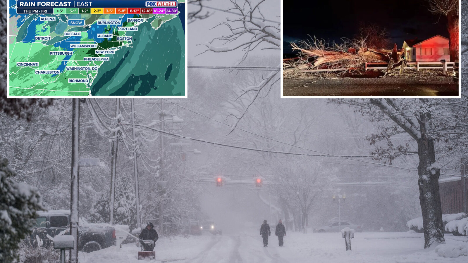
Farther south, this powerful coast-to-coast storm will deliver heavy rain to the Central Plains before expanding into the Mississippi and Ohio Valleys Thursday night.
Wind gusts in excess of 50 mph, and snow will remain the main concern for both drivers and those traveling by plane across the Dakotas, Minnesota, and Iowa.
Early morning rain is forecast to turn into snow by Thursday afternoon across the Dakotas, Minnesota, and Michigan, and whiteout conditions will again be the main travel issue through Thursday night.