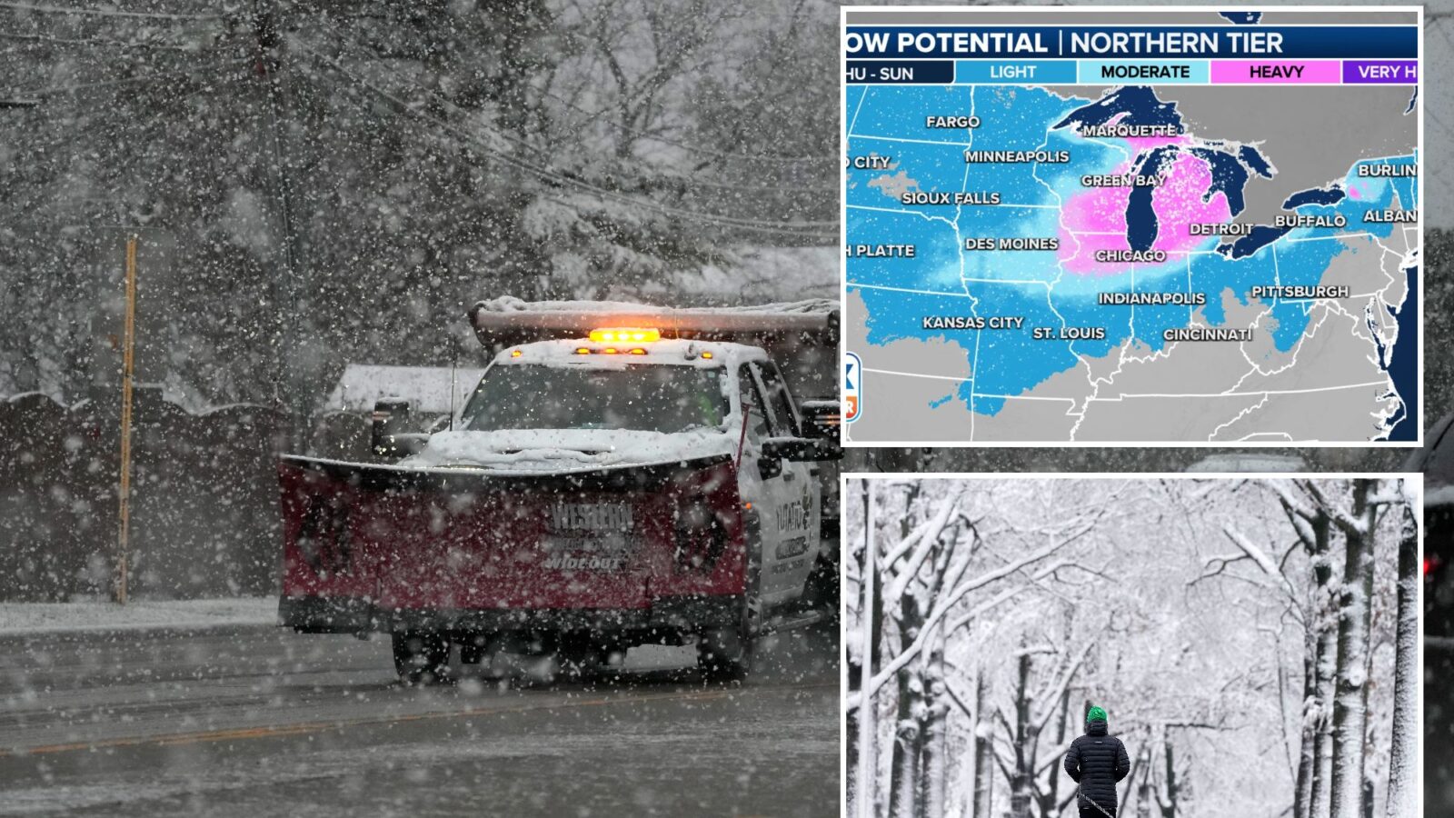
As one storm system exits the US, another is on its heels later this week, likely producing another round of heavy snow and severe weather in parts of the country that just wrapped up seeing their share of bad weather.
The Fox Forecast Center expects a band of heavy snow will fall from Missouri to Michigan, with severe thunderstorms possible from Texas through the Carolinas in the mid-Atlantic.
Similar to the past two storm systems, major cities in the Northeast will miss out on seeing accumulating snow, with temperatures simply too high to support frozen precipitation along the coast.
The storm system has already triggered blizzard warnings in higher elevations in the Pacific Northwest, and wind gusts have topped 100 mph on some ridges.
Major impacts are expected to begin late Thursday across the Plains and last until the storm system pushes into Canada and off the Eastern Seaboard on Saturday.
“We’ve already been through the weekend nor’easter that impacted the East Coast and this storm that we’re still kind of clearing out of,” said Fox Weather meteorologist Britta Merwin. “But the next one, it’s interesting.”
That’s because the track of the storm is similar to previous ones, though perhaps not exactly the same.
“A difference of a track between 50 and 100 miles makes a big difference to certain cities,” she said.
For example, Chicago didn’t see much snow from the previous system this week.
But that may change with this next storm later this week.
“The suburbs had much better totals,” Merwin said. “But this next storm at the end of the week, the positioning is better for Chicago to see more snow than what they just had.”
The snowfall is expected to be the lightest over the Plains and increase in coverage and intensity throughout the Great Lakes.
The first flakes are expected to start flying Thursday, with Chicago, Detroit, Milwaukee and Indianapolis all seeing accumulating snow by Friday.
The snowfall is expected to be the lightest over the Plains and increase in coverage and intensity throughout the Great Lakes.
Forecast models show some communities in the Great Lakes could pick up snowfall accumulations in the double digits with wind gusts of more than 30 mph.
The areas that will see the heaviest snow likely won’t be set in stone until around Thursday morning, when more accurate computer model runs will be able to determine where the storm system’s center will travel and how much cold air will be available.
The combination of the heavy snow and gusty winds could make travel impossible along the I-80 corridor, with frozen precipitation making it as far south as Interstate 40.
Cities such as Chicago and Detroit sit ready to at least double their snowfall accumulations for the season.
The Windy City has only reported around 6 inches of snowfall since Dec. 1, and Detroit has only seen a measly 1.1 inches of snow.
Where warm air will be dominant, south of Interstate 40, communities have the chance of seeing strong to severe storms.
NOAA’s Storm Prediction Center (SPC) has highlighted areas in the South days in advance of the actual storm system arriving, meaning that certainty is high for threats of damaging winds and tornadoes on Thursday and Friday.
