A widespread 1–3 inches of snow is expected from Indiana through Ohio and into Maryland, Washington, DC, New Jersey, and New York City beginning Saturday and lasting through Sunday morning.
Parts of southern New England as far north as Providence, Rhode Island, could see accumulating snow.
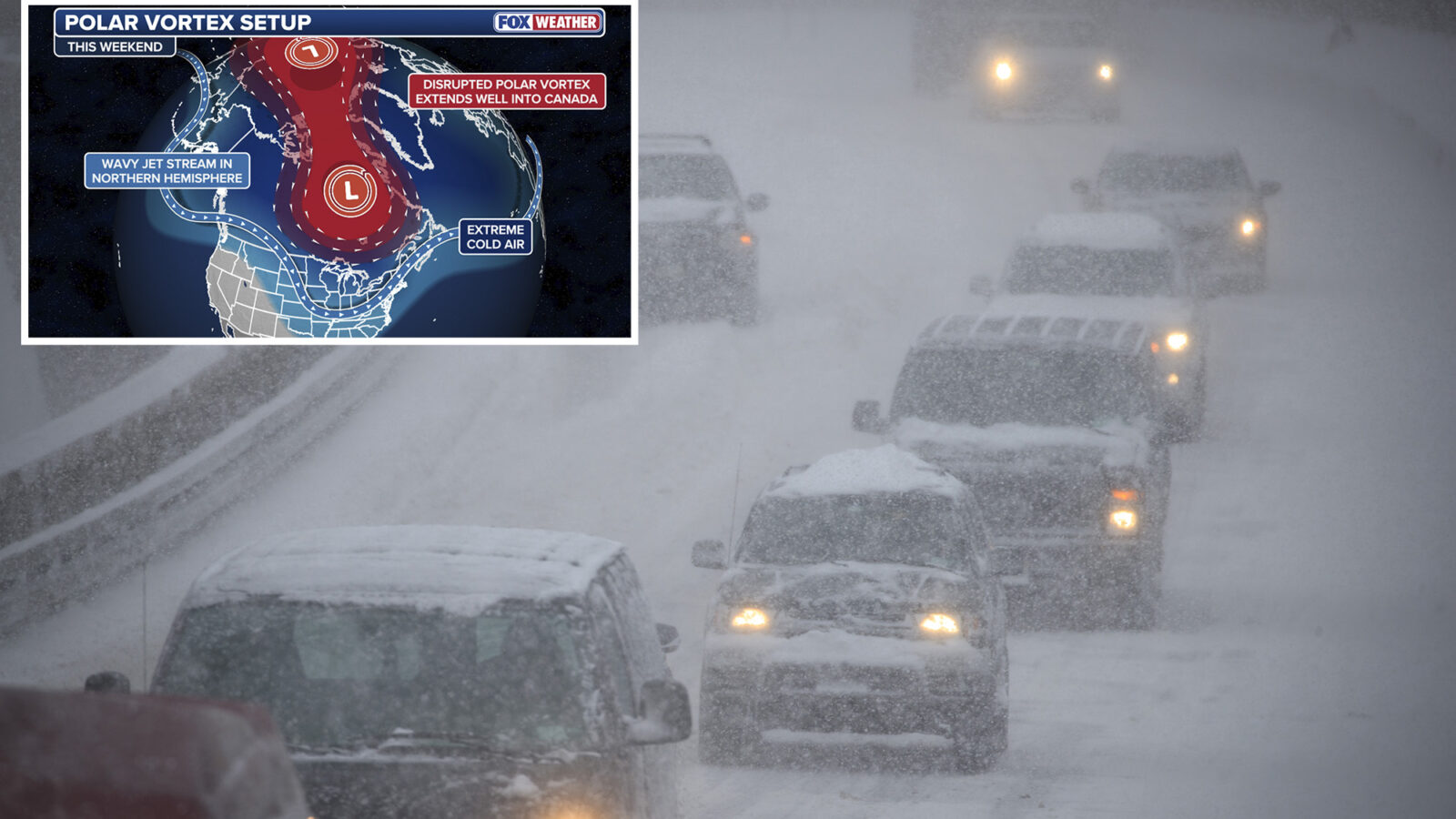
According to the FOX Forecast Center, the circulation of the polar vortex will weaken into the weekend, which will allow more cold air to spill into the Midwest and Northeast, priming the pump, so to speak, to turn any moisture that moves across the region into snow.
This comes after record low temperatures were already set on Tuesday in New England.
The polar vortex is a large, persistent area of low pressure and cold air near the poles and sits about 10 to 30 miles above Earth’s surface.
A strong polar vortex keeps the coldest air contained over the arctic circles; a weaker one allows that frigid air to drop into the lowest level of the atmosphere and dips in the Pacific jet stream usher that cold air from Canada into the Lower 48.
Computer forecast models have come into better agreement that snow will move into the Midwest and the Ohio Valley on Saturday. Indianapolis, Cincinnati and Columbus, Ohio, are all expected to see snow yet again on Saturday night, after a previous round of snow on Thursday and Friday.
Morning Report delivers the latest news, videos, photos and more.
Please provide a valid email.
By clicking above you agree to the Terms of Use and Privacy Policy.
Never miss a story.
Winter storm watches have been issued across Indiana, Ohio, Pennsylvania and West Virginia.
Snow is expected to move into the Northeast overnight Saturday, with people along the Northeast coast waking up to snow Sunday before the system quickly exits the region as early as Sunday afternoon.
Winter storm watches have been issued across Indiana, Ohio, Pennsylvania and West Virginia.
Currently, the heaviest snow from this fast-moving system is expected to track over southern New Jersey into Philadelphia and southwest through Washington, DC. These areas can expect 3–5 inches of snow.
While places like Washington and Baltimore have already received their first measurable snow of this winter, this will be the first significant snow for the Philadelphia and New York City metro areas.
Those with outdoor weekend plans in the region should stay updated for the latest timing regarding this forecast.
This latest storm bears out the long-range outlook from NOAA last month that forecast an active start to meteorological winter, due in part to the La Niña climate pattern.
Advertisement